Past IEM Features tagged: sep14
September Ranks
02 Oct 2014 05:43 AMClimate Districts are a spatial aggregation that exist between individual counties and states that provide a map unit to produce estimated climate data on. The IEM generates daily spatially averaged estimates of precipitation and high/low temperature for these climate districts and has daily data available back to 1893. The featured map displays the rank of the September total precipitation for each of these districts. A value of one represents the wettest month. Even within a climate district, there is plenty of variability as convective rain events are on a much smaller scale and thus lead to large district to district differences in some cases.
Voting:
Good: 18
Bad: 9
Abstain: 9
Tags: sep14
Mid 30s Coming?
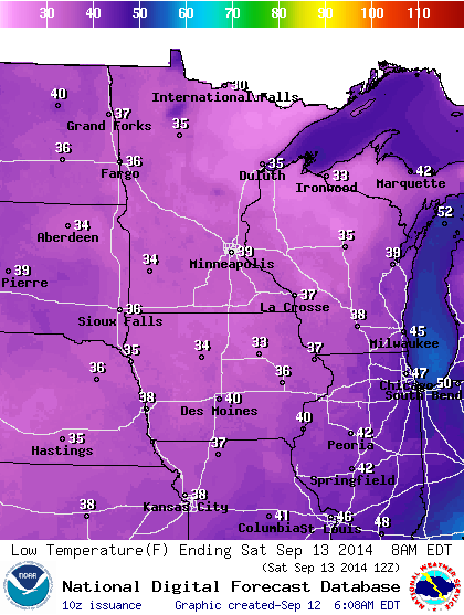
12 Sep 2014 05:45 AMThe featured map displays NWS forecasted low temperatures for Saturday morning. Mid 30s are expected over much of the state! It is very early in the season to see temperatures this cold. Snow fell on Rapid City, SD yesterday, which was the earliest recorded snowfall since they started keeping records there back in late 1800s. Temperatures will warm a bit after Saturday, but still be below average for the next week.
Voting:
Good: 21
Bad: 24
Abstain: 15
Tags: sep14
Intense September Rainfall
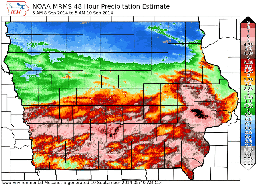
10 Sep 2014 05:47 AMHeavy rainfall has fallen over the past 48 hours with MRMS Q3 estimates showing much of southern Iowa in the 4-6 inch range. These estimates have been trending a bit too high lately with observations an inch or two less than what is shown. Some more rainfall is in the forecast, but totals will not approach what we have recently experienced. It will certainly start to feel like fall with temperatures well below average.
Voting:
Good: 18
Bad: 6
Abstain: 4
Tags: sep14


