Past IEM Features tagged: hpc
Next storm looks to miss us
19 Jan 2011 05:55 AMThe featured map is of forecasted snowfall probabilities exceeding 4 inches from the HPC. The next storm system looks to miss us just to our south with the heaviest totals near Kansas City. We will not miss out on the cold air though, with high temperatures in the single digits and teens.
Voting:
Good: 15
Bad: 10
Tags: hpc
Lets hope this does not verify
04 Jul 2010 07:02 AMThe feature map is forecasted precipitation from NOAA's HPC. They have forecasted a swath exceeding 9 inches in southeast Iowa for the next 5 days! Some of this precipitation is thanks to the remnants of Hurricane Alex, which has brought a tropical airmass to Iowa. Let us hope this forecast does not verify, for if it does, we will have even worse flooding conditions on our hands after the extremely wet June.
Voting:
Good: 49
Bad: 10
Tags: hpc
A Wet Christmas
23 Dec 2009 06:12 AMThe featured map is forecasted precipitation amounts from the HPC for the next five days. Most of the state is forecasted to receive above 1.5 inches of precipitation, what form that falls in remains the question. Regardless, adding this amount of water to the surface will surely mean hydrology issues (flooding) now, if it falls as rain, or later, with spring snow melt.
Voting:
Good: 61
Bad: 30
Tags: hpc
Foot of snow likely
08 Dec 2009 06:17 AMThe featured map is the HPC probability forecast of 12+ inches of snow through Wednesday morning. Snow is already falling this morning with snowfall rates expected to intensify by mid-afternoon. The major concern is then a significant increase in wind speeds this evening with near blizzard conditions likely for a good portion of the state. An interesting aspect of this storm is that having snowfall total robbing rainfall is unlikely, so all available moisture will go for snow production.
Voting:
Good: 41
Bad: 8
Tags: heavysnow hpc
8+ inch snow probabilities
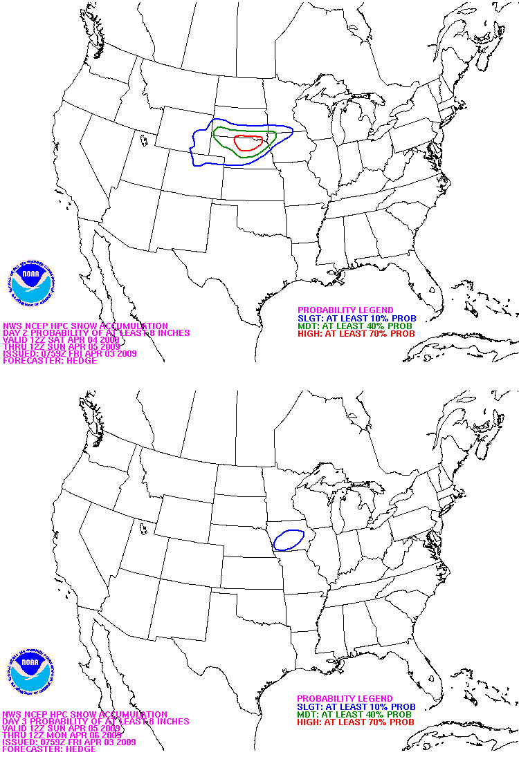
03 Apr 2009 06:20 AMNOAA's HPC has lucky portions of Iowa analyzed with a good chance to get heavy snowfall this weekend. The featured image shows the forecasts for Saturday and then Sunday. The center of the storm system will track just to our south, which often places Iowa in a favored position to get snow. The big question remains on how much of it will fall as snowfall total robbing rain!
Voting:
Good: 40
Bad: 23
Tags: hpc
First big storm of the season
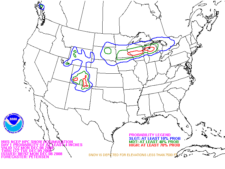
08 Dec 2008 06:31 AMThe featured map is forecasted probabilities of receiving over 4 inches of snow by Tuesday morning from the Hydrometeorological Prediction Center. Their forecast has the heaviest snow amounts just north of the state, while others have the depicted area shifted to the south with portions of Northeast Iowa expected to pick up upwards of 8 inches. Regardless, it is the first big winter storm of the year!
Voting:
Good: 22
Bad: 13
Tags: hpc
Stormy weather is back
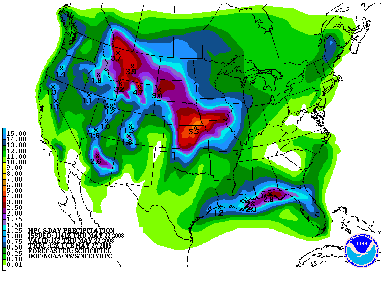
22 May 2008 07:28 AMThe 5 day rainfall forecast from the Hydrometeorological Prediction Center shows heavy rain expected from multiple rounds of storms that are set to impact our area starting today. The storm system will take some time to move east as the atmosphere is blocked up with a strong ridge overhead.
Voting:
Good: 19
Bad: 7
Tags: hpc
Where will the next rain fall?
11 May 2007 07:27 AMThe featured image is of forecasted rainfall for the next 5 days from the Weather Bureau. The heaviest amounts are forecasted in areas that could use a couple weeks of dryness, while Southeast Iowa is expected to see only near a half inch. Most of this forecasted rain will fall early next week.
Voting:
Good: 20
Bad: 12
Tags: hpc
How wet will it be?
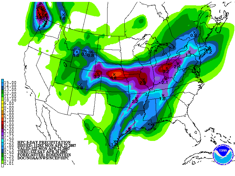
23 Apr 2007 07:14 AMThe featured map is a prediction of rainfall for this week from the Hydrometeorological Prediction Center. Some areas in Southern Iowa are expected to receive over 3 inches of rain while portions of extreme Northern Iowa may miss out all together. This map is bad news for farmers still wishing to get into the fields this spring.
Voting:
Good: 15
Bad: 5
Tags: hpc
More rain coming
30 Mar 2007 07:29 AMIt is a hard thing to curse the rain, since when it stops for a long period of time (drought) the impacts on agriculture in Iowa can be substancial. The featured image is of forecasted rainfall for the next 5 days showing the heaviest predictions of around 3 inches in extreme Western Iowa. There will be some threat for severe weather with these storms, but the primary impact will be flooding concerns.
Voting:
Good: 30
Bad: 10
Tags: hpc
A foot of snow coming?
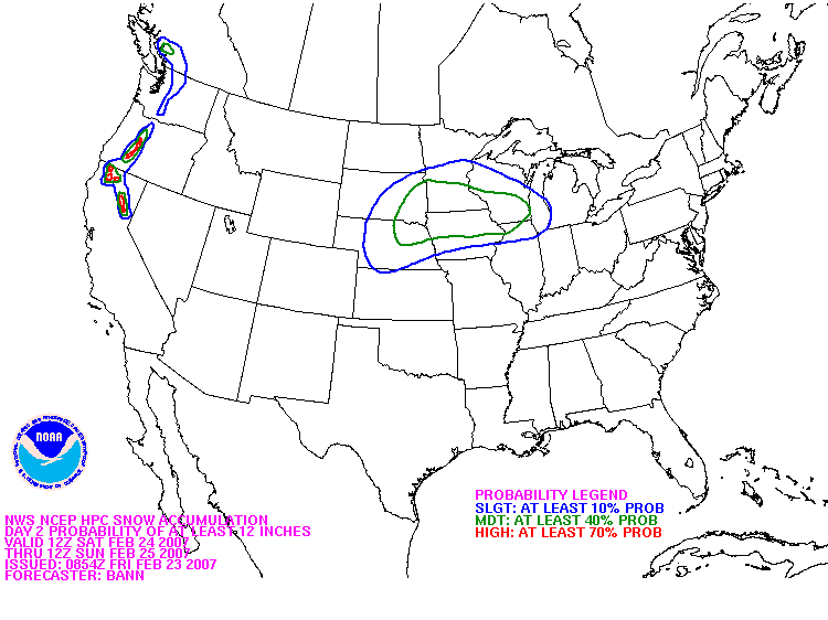
23 Feb 2007 07:13 AMThe featured image is forecasted 12+ inch snowfall probability for this weekend with a large area depicted under a moderate risk. This is all from a storm system that will develop today over the plains and shift east this weekend. Hail, damaging winds, and tornados will be possible over the southern plains with heavy rainfall expected as well. It is going to be an interesting weekend.
Voting:
Good: 34
Bad: 7
Tags: hpc
Best shot in a while
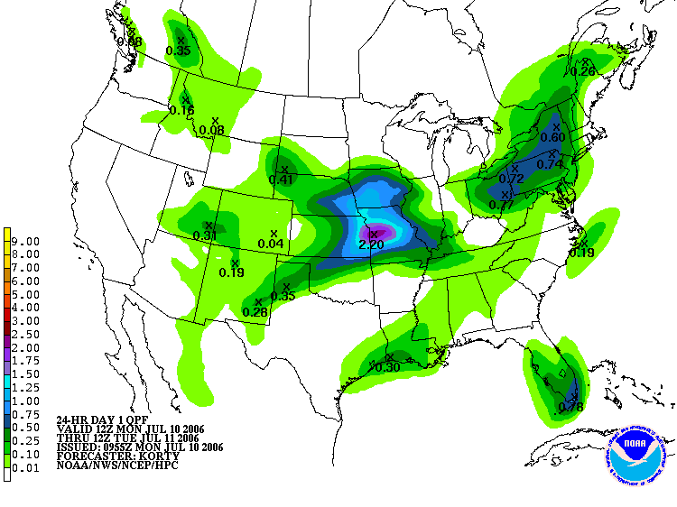
10 Jul 2006 07:09 AMThe Hydrologic Prediction Center has much needed rainfall falling over the state before Tuesday morning as a storm system passes to our south. This will be our best chance of rain for the next week or so. Hopefully this prediction is an underestimate.
Voting:
Good: 14
Bad: 7
Tags: hpc


