Past IEM Features tagged: heavyprecip
Heaviest rainfall since
19 Apr 2013 05:44 AMOur most recent storm was one for the record books as it appears it will rank in the top 5 for statewide heaviest rainfall. The featured map displays the reported daily precipitation for the ASOS/AWOS sites on Wednesday along with the period since the last event of as large amount. The heaviest swath fell from the Lamoni to Dubuque area with Ottumwa reporting nearly 5 inches, which makes for its largest one day total in 20 years! Monticello came in with just over three inches and its largest total in just under 10 years.
Voting:
Good: 72
Bad: 11
Tags: heavyprecip
Big Rain Event
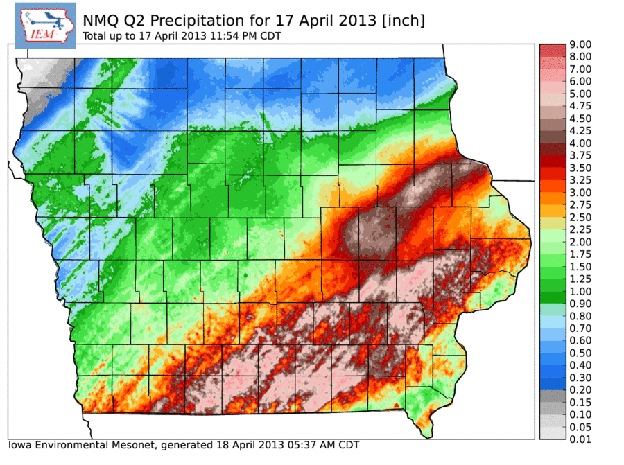
18 Apr 2013 05:48 AMRainfall was plentiful over much of the state on Wednesday as shown by the featured map of NOAA NMQ precipitation estimates. These estimates are primarily based off of RADAR information and show a large swath of the state in the 3-6 inch total range for Wednesday. So we are rapidly transitioning from a drought condition to flooding now with more precipitation on the way along with snow for northern Iowa. Based on some preliminary IEM estimates, yesterday's statewide averaged precipitation was 1.93 inches, which would be the highest calendar day total since 13 September 1961!
Voting:
Good: 94
Bad: 20
Tags: heavyprecip

