IEM Daily Feature
Friday, 21 February 2020
Friday, 21 February 2020
Snow Cover and Lows
Posted: 21 Feb 2020 05:33 AM
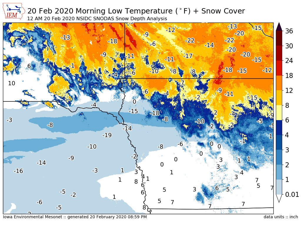
A strip of newly fallen snow and ideal atmospheric conditions for cooling conspired to create major
local differences for low temperature on Thursday morning. The featured map presents the
combination of morning low temperature reports for airport weather stations along with a grid analysis
of snow depth from the National Snow Ice Data Center. The map is centered on western Iowa and
the local differences between areas with snow and without snow cover is readily evident. Snow
cover is an efficient emitter of "long wave" radiation at night time and without clouds, the air close to
this surface has little hope of staying warm!
Voting:
Good = 22
Bad = 3
Abstain = 2
Tags: snowcover
Voting:
Good = 22
Bad = 3
Abstain = 2
Tags: snowcover

