IEM Daily Feature
Tuesday, 16 April 2024
Tuesday, 16 April 2024
Hatched Tornado Risk
Posted: 16 Apr 2024 05:37 AM
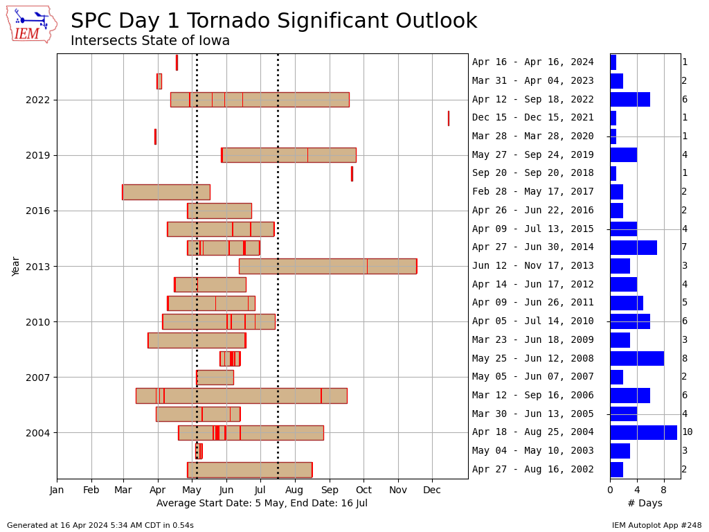
The Storm Prediction Center issues a number of products including a convective outlook, which provides a spatial analysis of severe weather risk. For the "Day 1" product, individual threat risks are forecast for tornadoes, damaging wind gusts, and hail. On the SPC website, one of the risk categories is colloquially known as the "hatched" risk as it is visually presented as a hatched area on the map, when forecast. This area represents the possibility of significant tornado, wind, or hail risks. For Iowa today, the present Day 1 outlook has much of Iowa within such a hatched risk for tornadoes, meaning a likelihood of EF2 and stronger tornadoes. The featured chart looks at the frequency and yearly period of such a risk threshold for Iowa. The right hand side denotes the first and last date each year along with the number of dates with such a risk threshold present. For Iowa, these events are thankfully only about a handful of times per year. The year 2021 is certainly an outlier with the only event being associated with the serial derecho on 15 December.
Voting:
Good = 13
Bad = 0
Tags: spc
Voting:
Good = 13
Bad = 0
Tags: spc