IEM Daily Feature
Thursday, 11 January 2018
Thursday, 11 January 2018
Flash Freeze
Posted: 11 Jan 2018 05:41 AM
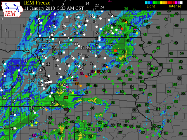
The term "Flash Freeze" appears to be relevant today as precipitation is falling over top a
very strong arctic front. The featured map shows the combination of near surface air
temperatures, road surface temperatures, and RADAR. The strong front can be seen with
temperatures in the 40s quickly dropping into the 20s along with precipitation happening on
both sides of this boundary. This creates a very dangerous situation as wet roads are
quickly exposed to temperatures well below freezing. After the freeze, snow will fall and
strong winds are expected to create near blizzard conditions. Going to be a tough travel
day today.
Voting:
Good = 18
Bad = 0
Voting:
Good = 18
Bad = 0

